We would need many more freeways

Architectural detail, Nakagin capsule tower (Tokyo, 1972) from Ignant.de

Architectural detail, Nakagin capsule tower (Tokyo, 1972) from Ignant.de

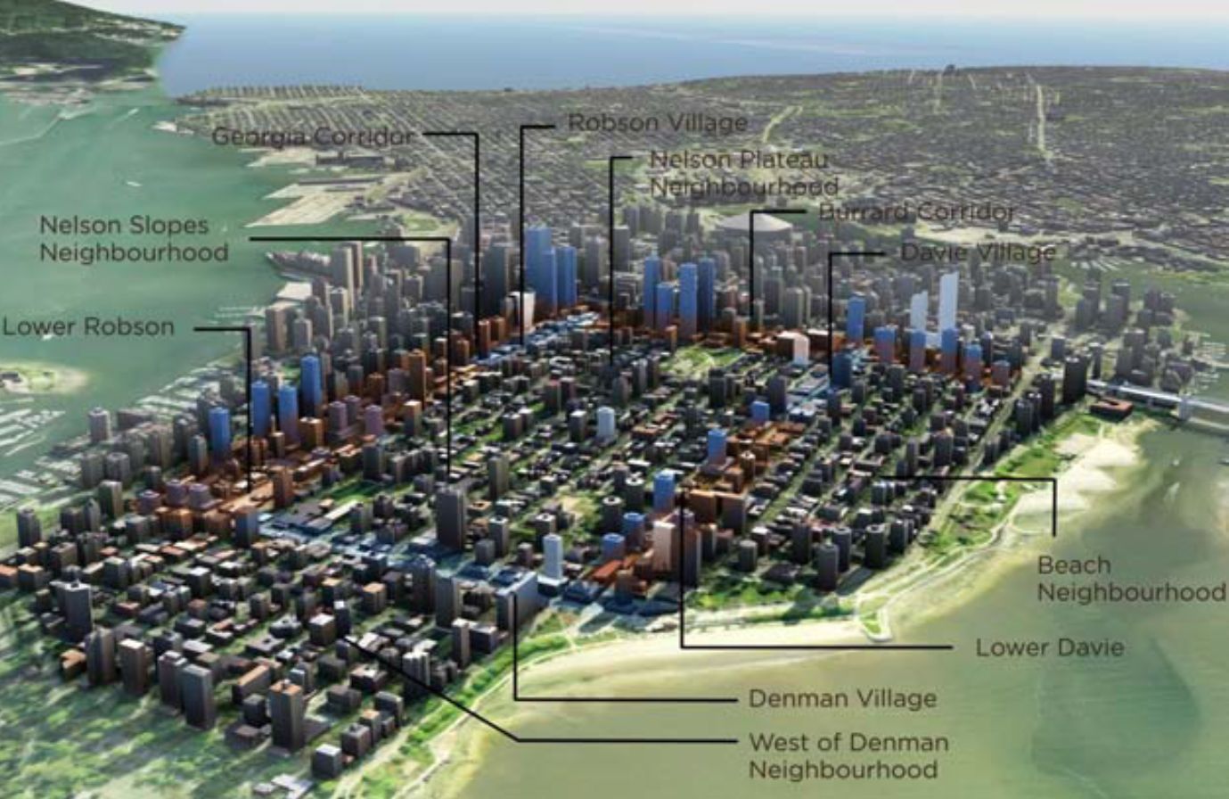
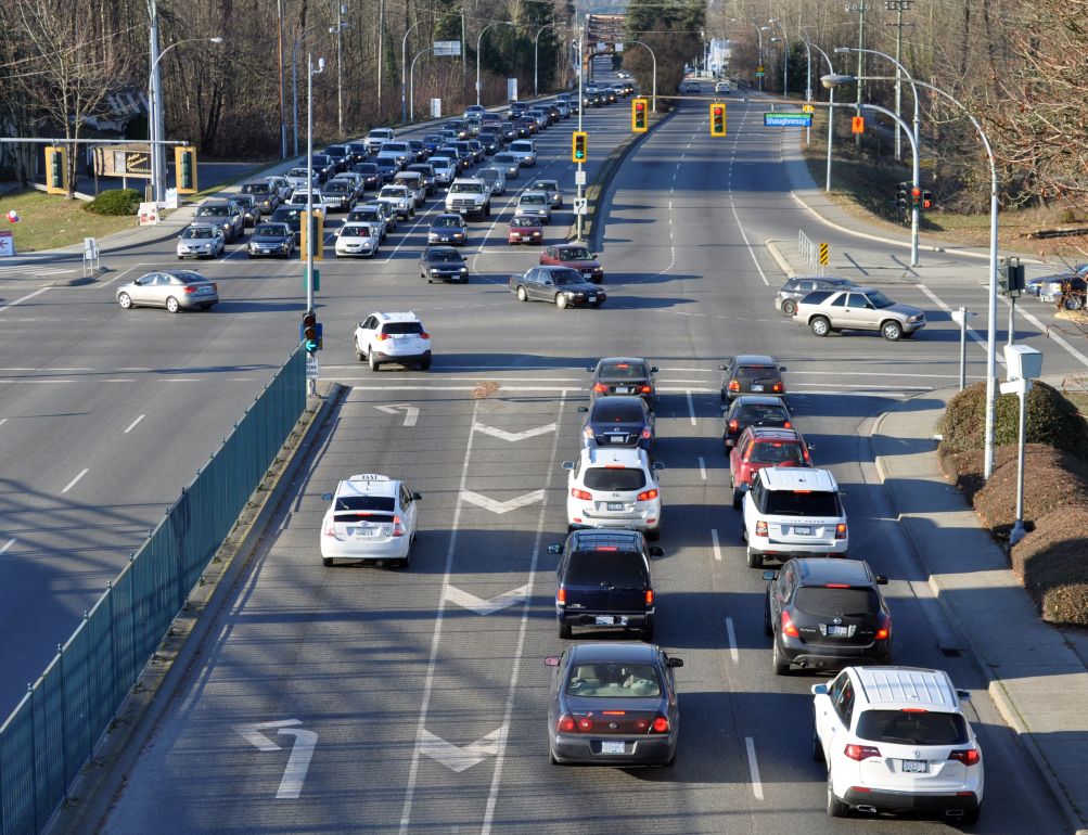
Combine two assumptions — further population growth in Metro Vancouver and continued vehicle use at the current rate — and the result is a big mess of trouble.

Blogger Gordon Price has flagged a recent mini-lecture/video by Matt Taylor [no longer available online].  It considers the effects on Metro Vancouver of having 730,000 additional cars on the road by 2041. This number is derived from the crude multiplier of forecast population growth times current vehicle miles driven per capita.

We would need to invest the equivalent of one rapid transit project per year to handle the additional traffic plus many billions of dollars for new parking spaces.

The proposition is ridiculous, of course. Mr. Taylor is campaigning for rapid transit as a better alternative.

Searching for controversy in the West End plan

Projected development in Vancouver's West End. The blue towers, mostly on Georgia and Burrard, represent future densification.

Projected development in Vancouver’s West End. The blue towers, mostly on Georgia and Burrard, represent future densification.

Two recent posts on Fraseropolis focused on Vancouver neighbourhoods — Grandview-Woodlands and Marpole — where resident activists have forced big delays in the City government’s area planning process.

Denman Street 2, Vancouver reducedIn Vancouver’s West End, however, City Council moved ahead last month with the adoption of a new community plan. This area is the finest urban village in British Columbia for access to services and urban life, at least as measured by the Fraseropolis index, and the City plan is advertised as a tool for preserving and enhancing these qualities. (The plan actually defines three West End villages — Robson, Denman, and Davie — but for an outsider from the deep ‘burbs, they blend comfortably together.) Continue reading

Driving is risky; walking, even more

Poco 1

The Insurance Corporation of British Columbia’s most recent crash statistics attracted scant notice from the media, despite the finding that 281 people died in automobile-related crashes in B.C. in 2012. This is in a population that carries 3.2 million operating licenses.

From 2008 through 2012, we lost an average of 331 people per year to traffic fatalities, the equivalent of having a packed airliner fly into Burnaby Mountain every Christmas Eve. This is an urgent matter for British Columbians, and for local governments in particular; but we tend to devote our attention to slighter issues, such as the unproven risks attached to the blips emitted by the electric company’s metering equipment. Continue reading

Fraseropolis Greatest Hits Volume 2

Vintage houses, Clarke Street, downtown Port Moody

Vintage houses, Clarke Street, downtown Port Moody

It’s more than two years since we launched this blog site, dedicated to reporting on the obvious features of local government and urban life in British Columbia’s Lower Mainland. The two subject counties, Fraser Valley and Metro Vancouver, are about half the size of Belgium when you put them together, with 2.65 million residents bunched up either in the valley itself or around the Burrard Inlet.

The pressures of paid work have reduced the rate of activity here, and the number of visits has dropped off as a result, but only slightly. I’ll provide a list of which posts have been visited most over the past year, as I did in November 2012. Only one of them, the live-work item, is a repeat. Continue reading