
A concept view of the future approach to the Clarke Road/Barnet Highway intersection, arriving from Vancouver on the Barnet. From the City of Port Moody draft OCP, March 2013
The City of Port Moody, a part of Metro Vancouver, has unveiled a draft Official Community Plan that would enable densification or superdensification along the new Evergreen rapid transit line, on track for completion in 2016.
The updated Community Plan, commissioned by City Council in early 2012, shows that Port Moody’s population grew from 18,000 in 1991 to 34,000 in 2011. Part of that growth anticipated the arrival of rapid transit with the creation of a pair of trendyish tower-dominated neighbourhoods, NewPort Village and its clone. The TriCity News reports that the proposed planning changes could help push the local population to 60,000. The paper’s un-named reporter appears to support the plan.
“While the OCP is not written in stone and public discussion must take place before the plan is passed, it should come as no surprise to anybody that the Evergreen Line will spur new development, new forms of housing and many more people. That is exactly the point of rapid transit. While people like to joke that rapid transit has taken decades to get here, the truth is, it’s being built for the future, not for today.”
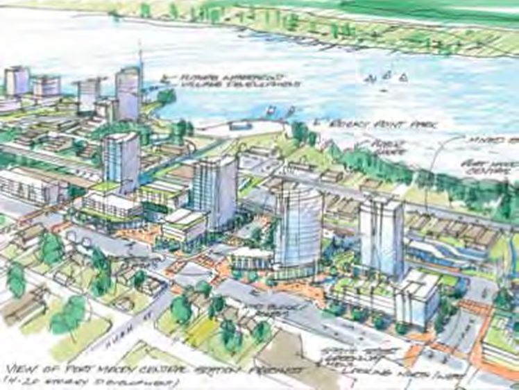
A rendering of the future Moody Centre development zone from the Port Moody draft OCP
The focus of planned densification is the future Moody Central transit station, roughly at the foot of William Street. The draft spring 2013 Plan (pages 89 and 108) describes a rapid-transit-oriented zone in a three-block stretch east and west of William north of St. Johns, with urban plazas and a mix of uses including seniors’ housing and live/work spaces occupying structures as high as 20 storeys. A March 5 memo from City staff on the draft plan lists six other lower-density development zones in the Evergreen corridor, including the “Gateway” zone pictured at the top of this post. [Note that the link in this paragraph should produce the early 2013 version of the draft plan; a revised document was issued in November 2013.]
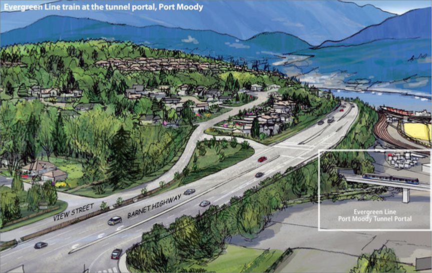
A provincial government depiction of the Evergreen Line emerging from under the Barnet Highway north of Clarke Road. It’s the same area that’s shown in the first drawing, minus the future property development that the City is imagining.
The draft Plan has emerged just as Evergreen Line construction has actually started. It was late 2000 when I attended a TransLink meeting in Port Moody to discuss the route for the project. On March 19, 2013, the City posted a notice on its website stating that tree and brush clearing was about to begin. On March 22, diverse politicians stood before the cameras to announce the names of the stations along the line. The project team faces numerous issues: there will be controversy around the relatively long distances between stations, the permanent traffic and access changes affecting established neighbourhoods, the displacement of older rental housing stock by new development, and widespread skepticism around the project budget and value for taxpayers.
I’ve had no business connection with the Evergreen Line project. As a resident of a suburb further east I support this investment, while recognizing that much of the rapid-transit-oriented development in the region has a sterile, windswept quality. We can only hope that Port Moody achieves better-than-average development results this time around. The draft plan appears to recognize the issues, promising “pedestrian scaled amenities” and “a softer, green edge to the built environment.”
I should also mention that Port Moody’s draft OCP goes well beyond transit corridor issues to look at environmentally sensitive areas, cycling, housing and much else. The plan is scheduled for adoption in May 2013 after a period of public comment.

