Looking across Como Creek to the proposed site of the Coquitlam waterfront village. The hillside in the left background is New Westminster.
As it stretches along the south side of Highway 1, much of Coquitlam’s United Boulevard is zoned “Highway Retail Industrial.”
 This loose designation has enabled the development of a sprawling big-box retail precinct. A City handout counts 18 large-scale furniture stores along United Boulevard, blending into the warehouse and fabricating shop uses that extend down to the Fraser River. [This document was taken out of circulation; as of 2016, the City website referred to a “multitude” of stores.]
It’s not a place where normal people go to walk, but my co-tourist Lawrence Wang and I ventured out on a Sunday afternoon, braving the Boulevard, its parking lots and deserted industrial side streets. We ended at the only café in the district, a Tim’s, which was (inevitably) humming. “Where do all these people come from?” Lawrence asked. “Furniture shopping, I guess.”

Furniture stores. The building through the centre houses the tolling offices for the Port Mann Bridge.
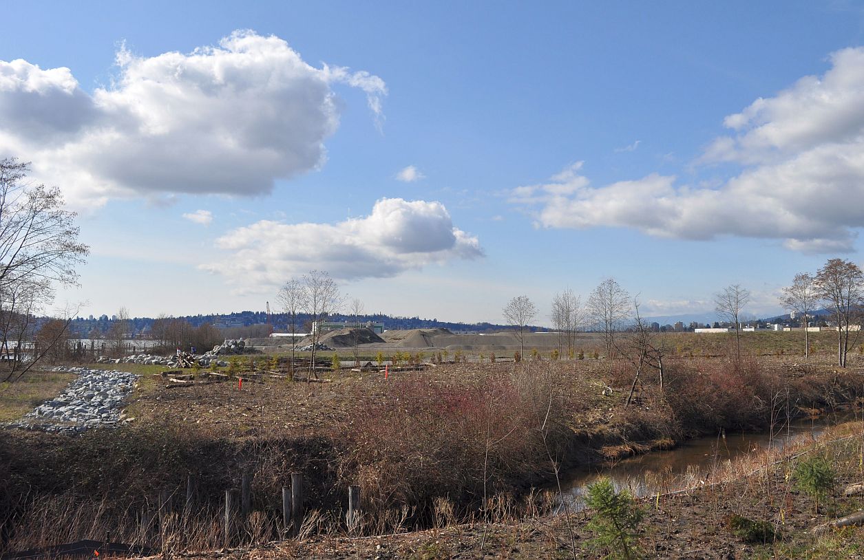
On our way to Tim’s we discovered a walking path that led from the Boulevard along Como Creek to a pocket- sized park on the waterfront. In recent years, the lands west of the creek have stored sand and rocks for the Port Mann Bridge/Highway 1 megaproject. However, an area plan adopted by the City in 2008 would transform 36 acres of industrial land into a mixed residential/ industrial “village,” with housing for as many as 8,000 people, organized around a walkable eight-block retail high street.
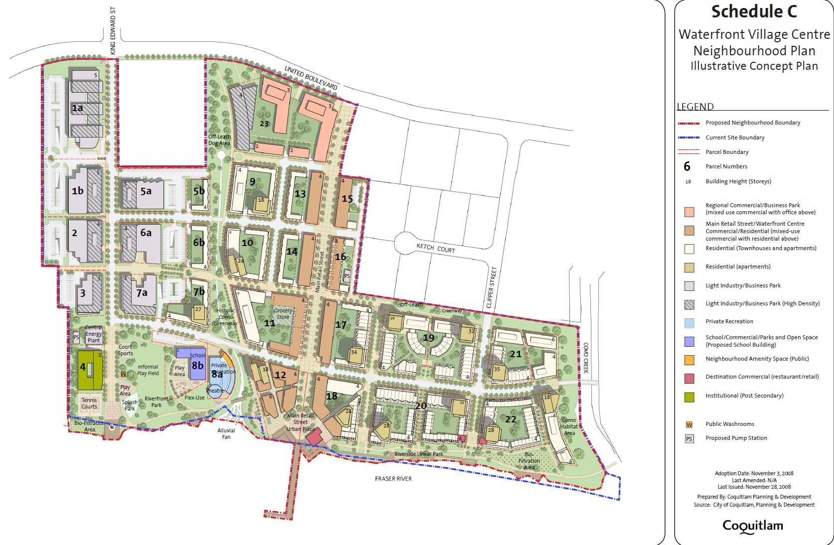
The City document that envisions this transformation is 56 pages long, and full of satisfying suggestions for making the new community nice. Its policies would
- support public transit investment
- increase the viability of local economic ventures
- require residential buildings to be built to a minimum of LEED or Built Green BC silver equivalency
- develop a district energy system
- encourage the settlement of a diverse population through housing choice.
The area plan shows a mid-rise approach to building Fraser Mills; a 2012 concept drawing unveiled by Beedie Development is more tower-heavy.

A rendering from Coquitlam’s 2008 plan

A 2012 posting from the Beedie Living site
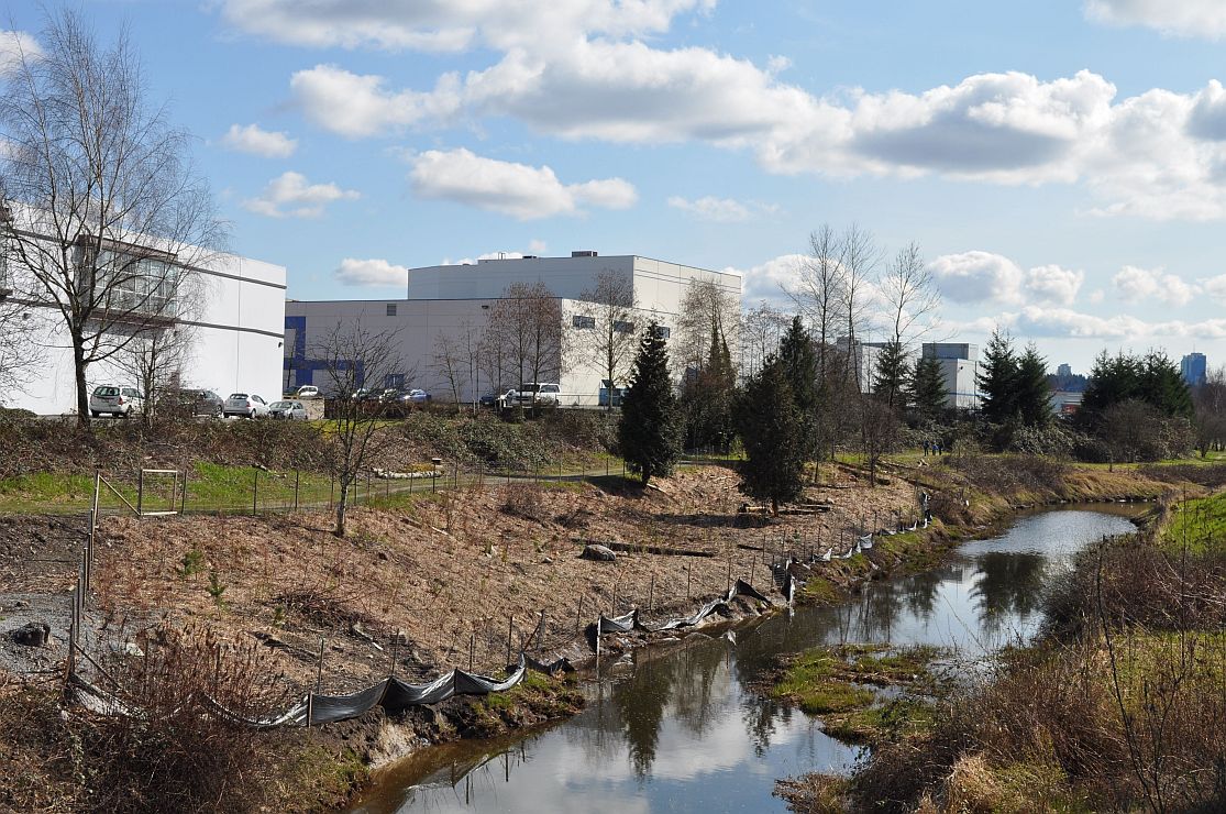
Como Creek, east side
In either case, implementing the plan would present a major challenge to a city that has bypassed the urban village form over the past generation. In principle, I support the side-by-side location of residential and industrial uses; but we’re starting here with a large and bland stock of industrial structures around the Fraser Mills perimeter. And once a resident walks through that industrial screen, there is little interest along United Boulevard (okay, there’s Tim’s, and the casino next door) or on the north side of the Freeway (Boston Pizza, IKEA).
The Highway 1 upgrades, started in 2008, are substantially complete, but there’s still some work required to finish off the major interchanges. When the last orange cone is removed, one presumes that the Fraser Mills lands will be open for development, starting with new city streets and sidewalks. We shall see.
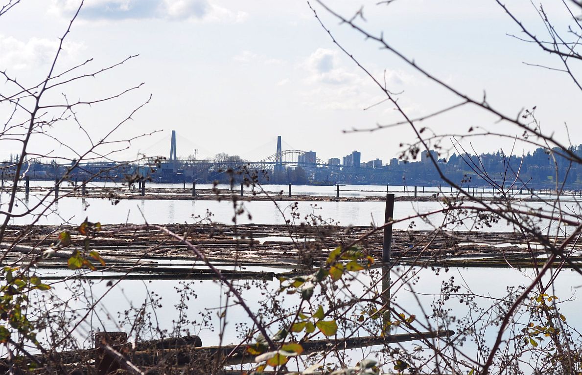
Looking down the Fraser River from the mouth of Como Creek

Pingback: Coquitlam’s waterfront plan | SENTURA PROPERTIES
This is an incredibly interesting project but honestly i wonder if it’s really possible to create a vibrant, bustling community as shown in the renders while the area is cut off from the rest of the city by the imposing barrier that is the railyard.
Thanks, Zack. It would be possible to build across a railyard — there are some very cool areas in old rail districts in Paris, London and elsewhere — but the problem here is that you also have a freeway, a major highway (Lougheed), and a major arterial (United) in the same corridor, along with a lot of dead big box space. Good luck to them anyway; perhaps they will run a False Creek style bobble boat to New Westminster quay.
Reblogged this on Lakeside Terrace.