
The Coquitlam urban core, from a 2013 municipal presentation. City Hall is the low-rise complex upper left. At least three new towers have joined this set within a 16-month period.
The streets behind the Coquitlam Centre mall feel like a pop-up city, construction dust still filtering down from unfinished towers.
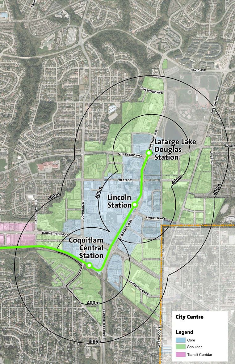 This is the core of a designated Coquitlam City Centre planning area, slated to double in population to more than 50,000 in the next two decades. The municipal government’s 2002 area plan sees the densified city centre as the future “arts, entertainment and cultural focal point for the Northeast Sector of the Metro Vancouver Region.” The northeast sector, by most definitions, stretches from Port Moody to Maple Ridge, and will house (hypothetically) half a million people by 2040.
The Coquitlam urban core is organized to feed off the Evergreen rapid transit line, still under construction. The neighbourhood is not quite as new as it feels; there have been several years of tower development with rapid transit in mind, as noted in one of my earliest posts. City planners and politicians deserve credit for anticipating the transformative effects rapid transit will have.
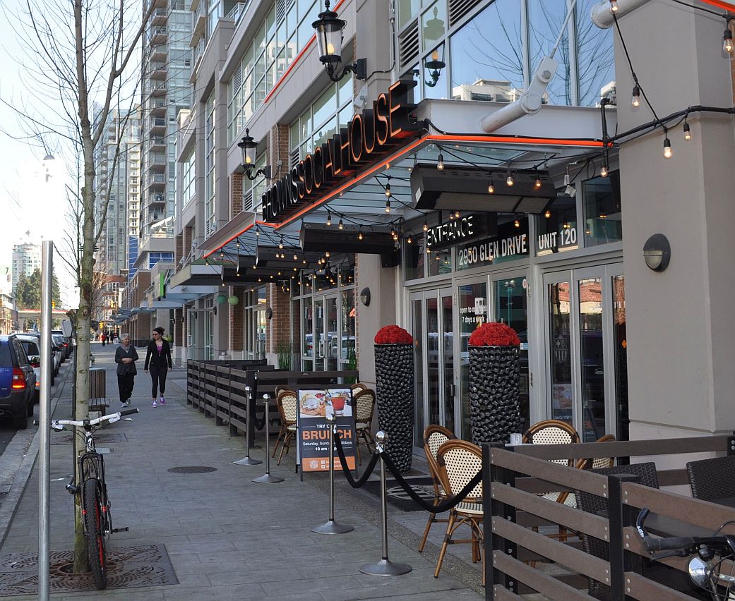 However, the core is only starting to show a flicker of personality as street-level commercial services take hold and create some mental distance between the tower-dominated streets and the nearby mall. As in Burnaby’s Metrotown precinct, which also continues to sprout towers, the names on the restaurants and professional offices suggest a heavy influx of Asian immigrants, especially Chinese.
I recruited our friend David Jung to come along as co-tourist on a Sunday afternoon tour. David once lived in a nearby residential area, before any towers were built, and now lives up the hill on Westwood Plateau. We looked at the street layout and the shop fronts, and also for evidence of poverty, working from a 2014 child poverty map of Metro Vancouver that shows a high concentration of low-income residents in the Coquitlam core, as in Metrotown..

Detail from the Metro Vancouver child poverty map, derived from Statistics Canada data. The black wedge corresponds to the Coquitlam city core.
We did not see the homeless or the addicted, as you might on any afternoon in my Maple Ridge neighbourhood; and we did not see agencies to serve such people. In fact, a scan of Coquitlam social service agencies shows a concentration in a much different part of the city, eight or nine kilometres south and west.
I suggested the poverty in the core might be transitional; Asian immigrants working at low wages, living in close quarters but saving money. David’s parents took an apartment in Vancouver’s Chinatown when they first arrived in Canada more than half a century ago. If they immigrated today, they might land in Coquitlam. David had a supplemental thought, suggesting that many Asian residents draw financial support from families across the water and don’t report income in Canada.

The Evergreen Line above Pinetree Way, seen from outside the public library
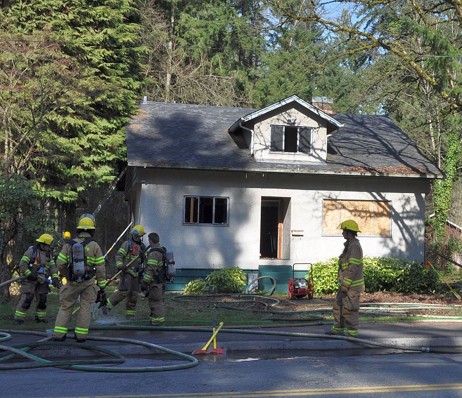
A boarded-up house east of Pinetree, one of a row waiting for redevelopment. On the day of our tour, someone had set fire to the house.
The pace of change here is astonishing. The concrete light-rail guideway appeared almost overnight in early 2015. There’s more here than I expected. Coquitlam, one of British Columbia’s largest cities, has always lacked focus. It seems this will change. I’ll return soon to look at the wider City Centre area — the college, the lake, the quieter residential streets — that might blend together someday to make this a community.
