
Columbia Street, showing the Sapperton area’s “Brewery District,” a nearly-complete development built on the site of a vanished industrial brewery. The head office of the regional transportation authority (TransLink) sits in the foreground. A new residential tower peeks out from behind.

An abandoned house, pre-1900, looking across Columbia Street to the new Brewery District offices
Sapperton, as defined in the City of New Westminster maps, is a long rectangle with no adjacent residential neighbourhoods to the east or north. With recent development, Sapperton has become more self-contained and livable; proposed further development would add thousands more residents at the eastern edge, with unforeseeable results.
As I drove to meet co-tourist Bob Smarz for a walk through Sapperton, an item on the radio about the city’s historic cemetery reminded me that this is, in one sense, the birthplace of British Columbia. The Fraser Cemetery on the hill above Columbia Street is the oldest in the Lower Mainland region: its dead include veterans of the American Civil War who moved to Canada, and presumably some Sappers, or British Royal Engineers, who landed on the Fraser River shore around 1860 to build B.C.’s first administrative capital.
The urban landscape in Sapperton today combines every period from the late 1800s to the present. There was clearly one wave of construction during the great land boom around 1912, and another one in the 1920s. The Richard McBride school dates from 1929, and a couple of the older structures on the high street display an art deco look, as in Cloverdale, a commuter rail town in the South of Fraser that thrived during the same period. One of the most common housing types is the 1,000-square-foot single-storey bungalow, dating from around 1950; with rising property values, these are being replaced by squarish houses with three to four times the floor space.

New Westminster communities, showing Sapperton at the eastern end, from a neighbourhood profile issued by the City of New Westminster. Fraseropolis has also published posts on Uptown, Downtown and Queensborough.

Single-family home c. 1914, probably from a catalogue plan, next door to a new arrival.
The dominant feature in this part of New West is the Royal Columbian Hospital, one of the largest and busiest in the province. Just as the ICBC Claim Centre in Maple Ridge has attracted a cluster of auto glass and body shops, the Royal Columbian has drawn together an impressive array of medical offices and clinics. The hospital and the medical offices create a long divide between Columbia Street’s old Sapperton commercial strip to the north and the new Brewery District shops and offices to the south.
For this blog site, we visit such places partly to think about their livability. Having an active commercial high street is not the only test of an urban village — you also need a mix of housing, connections to transit, and some other stuff — but the availability of essential goods and services is a critical test. The old Sapperton strip, with its echo of Cloverdale, has a bike store, a couple of thrift stores and some cafes. This does not do the job.
With the addition of a bank and a supermarket in the Brewery District development, Sapperton becomes an urban village. Even so, and even with a pleasant lunch at Gino’s Restaurant, Mr. Smarz noted the relative shortage of commercial and public services, and of pedestrian points of interest.
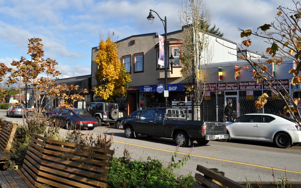
A vintage commercial structure and Cloverdalesque street furniture, Columbia Street.

Brunette Street seen from the back of the Brewery District, with the Sapperton transit station on the far side and new residential tower construction on the left.
The City’s neighbourhood profile document, based on the 2006 federal census, suggests there might be 3,000 people currently living in the Sapperton rectangle on the map above. The new 230-page Official Community Plan, adopted by New Westminster’s elected council in September 2006, provides slight guidance on how the rectangle will be developed as a community. The longest reference, around page 173, shows that future development will be transit-focused, with up to 800 new housing units at Sapperton Station by the year 2041, and as many as 2,300 at Braid Station.
The master plan for the Braid Station project, known as Sapperton Green, is currently in public consultation phase. The plan portrays a whole new village at least equal in population to the existing Sapperton community, with 11 towers and a commercial centre. This village would be oriented to SkyTrain and the Highway 1 expressway. The 10-minute walk to the modest attractions of Columbia Street might be a low priority for most of the new residents.
[This is post #37 in our Urban Villages series.]
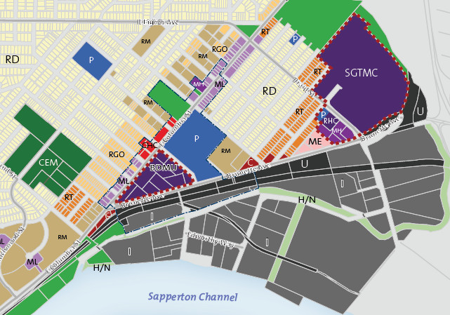
Land use in Sapperton: a detail from the 2017 city plan, showing a wide industrial zone to the south, and the proposed Sapperton Green Transit-Oriented Mixed-Use Community (SGTMC) to the east
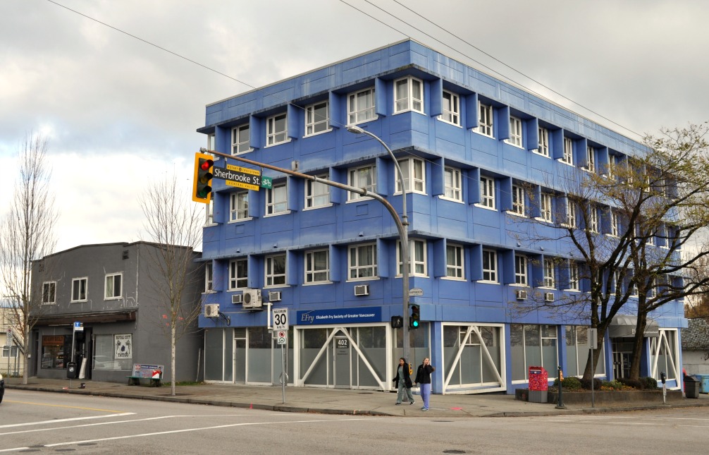
Medical offices on Columbia Street by the hospital.

Part of the Royal Columbian hospital along Columbia Street

A Vancouver-style residential tower in the Brewery District

Ward Street, off Columbia

Early ’50s bungalow, Blair Street

Layout of the proposed Sapperton Green village, from a 2017 city report
