Transforming Metrotown

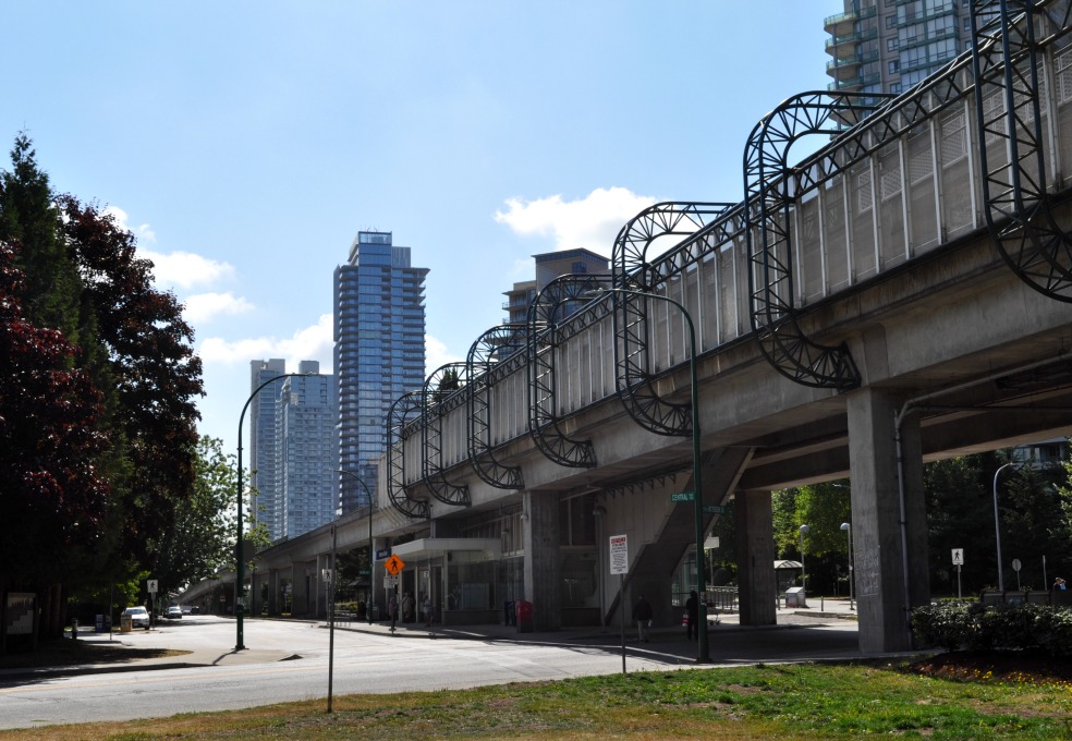
Paterson SkyTrain station, looking to new residential towers south of the Metrotown shopping complex

The older retail blocks on Kingsway near the mall have struggled over the years. Tenants include payday loan shops, tattoo parlours and porn outlets.

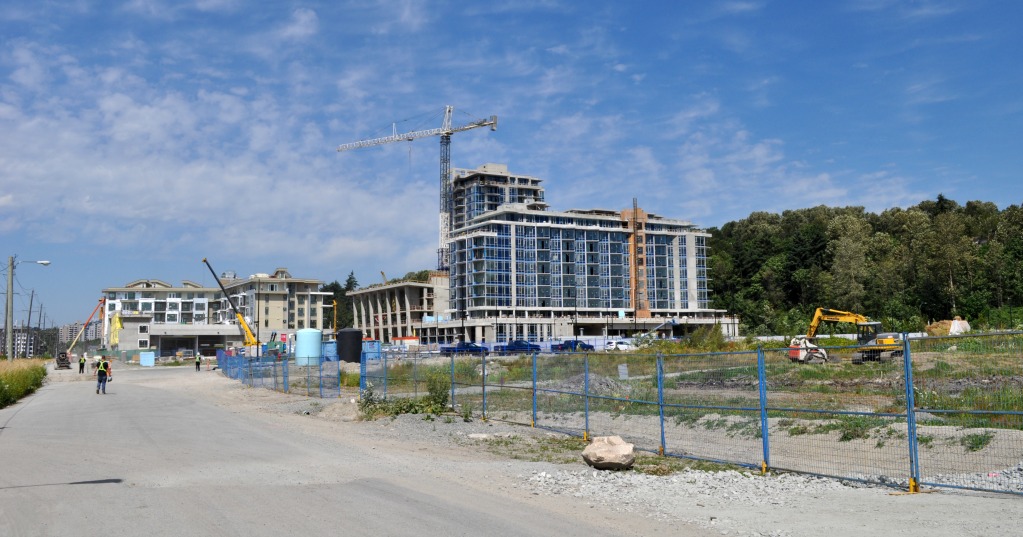
The City of Burnaby has adopted a new long-term development plan for the Metrotown district. By 2040, Metrotown is to be transformed by the redevelopment of its signature shopping malls into a “finergrained network of public streets, lanes, pedestrian connections, plazas, squares, parks, and open spaces.” Metrotown is to become a classic downtown core in a suburban city of 240,000 that has lacked a focus until now.

The July 2017 plan replaces a 1977 document that, visually at least, had a creepy, adopted-by-aliens vibe. The old plan facilitated the growth of the Metrotown shopping complex, Canada’s second-largest indoor shopping centre, along with a surrounding ring of apartment towers. The shopping centre is a busy place with an enormous variety of services, but it shows blank facades to the outside world. As I pointed out after my 2012 visit, the streets and concrete plazas around the mall lack life and colour. Continue reading

A development surge in Vancouver’s River District

The River District, in Vancouver’s extreme southeast corner, offers a quiet riverside walk, lunch at a good pub restaurant overlooking the water, and a feeling of imminent transformation.

The area was identified for conversion from industrial to residential use at least as early as 2004. At that time, residential development was already proceeding in a former industrial area to the west, in a two-block-wide band between Marine Drive and the Fraser River. Continue reading

In the shadow of Vancouver’s traffic viaducts

Vacant lands next to False Creek in downtown Vancouver. The city government’s plan will see the removal of two elevated roadways, the extension of a waterfront park and up to 20 new residential towers.

The first Georgia Street automobile viaduct was built in 1915 as a bridge over railways and industrial lands. The current Georgia and Dunsmuir Street viaducts are orphan remnants of a failed plan to run a freeway from Highway 1 into downtown Vancouver.

2011 study reported that the viaducts carry about 40,000 vehicles every day. However, Vancouver Council voted in 2015 to tear them down and tidy up the underlying street network. The viaducts are ugly, and they’re a waste of land: it’s estimated that their removal will enable the development of housing for as many as 10,000 people. Continue reading

Pitt Meadows 1 — Osprey Village

The recently completed commercial core of Osprey Village. The brick-faced structure in the foreground was approved as a live-work development, with shopowners living above their businesses.

The city of Pitt Meadows, British Columbia, population 18,500, has shown how a small municipality can function effectively in a large urban region. Residents enjoy relatively low property taxes and much the same services as  Surrey, a nearby city with a half a million people.

Osprey Village, a Pitt Meadows neighbourhood overlooking the Fraser River, was built over the past decade with patience and (I think) good taste, at least compared with the competition in other Fraseropolis suburbs. The commercial zone pictured above is short on everyday services and heavy on dog spas and craft galleries, but it’s attractive and cozy, and is now a mini-tourism destination for cyclists and for families looking to walk along the river. (Osprey is at the western end of a regional pathway network, and not far from the Golden Ears Bridge; cycling links to Coquitlam and Langley are excellent.) The 2009 land use plan adopted by City Council in 2009 provides for up to 25 live-work units on the main street or immediately behind, and the community hall by the river park acts as a regional conference centres, so there’s continued pedestrian traffic in the Osprey village centre even on weekdays. Continue reading